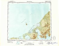
USGS Topo Quad Fort Randall, Alaska
Download Fort Randall
Download Fort Randall
Southern Latitude:
55.0000 N
Eastern Longitude:
-162.0000
Northen Latitude:
56.0000 N
Western Longitude:
-164.0000
Archipelago(s) in Fort Randall
Kudiakof Islands,
Bar(s) in Fort Randall
Bear Rock,
Bay(s) in Fort Randall
Applegate Cove,
Bear Bay,
Belkofski Bay,
Big Lagoon,
Blaine Bay,
Captain Harbor,
Cold Bay,
Gerstle Bay,
Hook Bay,
Izembek Lagoon,
Izembek Slough,
King Cove,
King Cove Lagoon,
Kinzarof Lagoon,
Kitchen Anchorage,
Lenard Harbor,
Littlejohn Lagoon,
Middle Lagoon,
Moffet Lagoon,
Mortensens Lagoon,
Morzhovoi Bay,
Norma Bay,
Nurse Lagoon,
Saint Catherine Cove,
Swanson Lagoon,
Cape(s) in Fort Randall
Belkofski Point,
Blaine Point,
Boiler Point,
Bold Cape,
Cape Glazenap,
Cape Krenitzin,
Cape Leontovich,
Cape Lieskof,
Chunak Point,
Delta Point,
Gerstle Point,
Grant Point,
Indian Head,
Kaslokan Point,
Kelp Point,
Moffet Point,
Morgan Point,
Otter Point,
Reynolds Head,
Rocky River Point,
Slavna Point,
Vodapoini Point,
Island(s) in Fort Randall
Amak Island,
Birdsall Island,
Cove Island,
Glen Island,
Isanotski Islands,
Neumann Island,
Operl Island,
Round Island,
Sealion Rocks,
Table Rock,
Lake(s) in Fort Randall
Lake Gilbert,
Big Lake,
Blinn Lake,
Blue Bill Lake,
Emmons Lake,
Lake Hess,
Johnny Lake,
Little Lagoon,
Old Mans Lagoon,
Rescue Lake,
Simeon Lake,
Thinpoint Lake,
Lake Trelford,
Mountain(s) in Fort Randall
Aghileen Pinnacles,
Black Hill,
Mount Dutton,
Mount Emmons,
Frosty Peak,
Mount Simeon,
Pillar(s) in Fort Randall
Aghileen Pinnacles,
Range(s) in Fort Randall
Black Hills,
River(s) in Fort Randall
Cathedral River,
Joshua Green River,
Stream(s) in Fort Randall
Coal Oil Creek,
Delta Creek,
Lansberg Creek,
North Creek,
Otter Point Creek,
Valley(s) in Fort Randall
Cathedral Valley,
Village(s) in Fort Randall
Belkofski,
Cold Bay,
King Cove,
