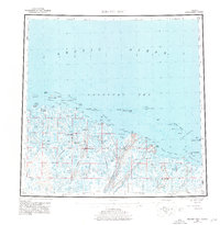
USGS Topo Quad Beechey Point, Alaska
Download Beechey Point
Download Beechey Point
Southern Latitude:
70.0000 N
Eastern Longitude:
-147.0000
Northen Latitude:
71.0000 N
Western Longitude:
-150.0000
Archipelago(s) in Beechey Point
Jones Islands,
McClure Islands,
Niakuk Islands,
Return Islands,
Spy Islands,
Area(s) in Beechey Point
Kuparuk River Delta,
Sag Delta Number 1,
Sagavanirktok River Delta,
Bar(s) in Beechey Point
Boulder Patch,
Cat Shoals,
Loon Shoal,
Stamukhi Shoal,
Bay(s) in Beechey Point
Foggy Island Bay,
Gwydyr Bay,
Mikkelsen Bay,
Placid Et Al State Number 1,
Prudhoe Bay,
Simpson Lagoon,
Stefansson Sound,
Cape(s) in Beechey Point
Anxiety Point,
Back Point,
Beechey Point,
Point Brower,
Heald Point,
Kavearak Point,
Lion Point,
Point McIntyre,
Milne Point,
Oliktok Point,
Reliance Point,
Point Storkersen,
Channel(s) in Beechey Point
Newport Entrance,
Hill(s) in Beechey Point
Jones Mound,
Kuparuk Mound,
Prudhoe Mound,
Shaviovik Mound,
Thetis Mound,
Island(s) in Beechey Point
Argo Island,
Bartlett Island,
Bertoncini Island,
Bodfish Island,
Cottle Island,
Cross Island,
Dinkum Sands,
Duck Island,
Egg Island,
Foggy Island,
Foggy Island,
Foggy Island,
Gull Island,
Howe Island,
Jeanette Island,
Karluk Island,
Leavitt Island,
Long Island,
Midway Islands,
Narwhal Island,
Pingok Island,
Pole Island,
Reindeer Island,
Stump Island,
Tigvariak Island,
Lake(s) in Beechey Point
Microblade Lake,
Mountain(s) in Beechey Point
Beechey Mound,
River(s) in Beechey Point
Kadleroshilik River,
Kavik River,
Kuparuk River,
Putuligayuk River,
Sagavanirktok River,
Sakonowyak River,
Shaviovik River,
Ugnuravik River,
Stream(s) in Beechey Point
Fawn Creek,
Village(s) in Beechey Point
Deadhorse,
Prudhoe Bay,
