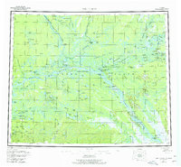
USGS Topo Quad Fort Yukon, Alaska
Download Fort Yukon
Download Fort Yukon
Southern Latitude:
66.0000 N
Eastern Longitude:
-144.0000
Northen Latitude:
67.0000 N
Western Longitude:
-147.0000
Bar(s) in Fort Yukon
Englishshoe Bar,
Cape(s) in Fort Yukon
Okalee Spit,
Willow Point,
City(s) in Fort Yukon
Fort Yukon,
Flat(s) in Fort Yukon
Jefferson Meadows,
Yukon Flats,
Hill(s) in Fort Yukon
Shotuih Hill,
Island(s) in Fort Yukon
Deadman Island,
Egil Island,
Homebrew Island,
Jenny Island,
Rodman Island,
Saloon Island,
Toussaint Island,
Twelvemile Island,
Lake(s) in Fort Yukon
Abraham Lake,
Applevun Lake,
Bearman Lake,
Beaver Lake,
Black Currant Lake,
Burman Lake,
Cabin Slough,
Cache Lake,
Canvasback Lake,
Chahovun Lakes,
Chissovun Lake,
Chloya Lake,
Clam Lake,
Crosstrail Lake,
Emile Lake,
Gailey Lake,
Gas Lake,
Geese Lakes,
Gilbert Lake,
Graveyard Lakes,
Gull Lake,
Halfway Lake,
Hat Lie Lakes,
Hospital Lake,
Jefferson Lake,
John Roberts Lake,
John Steven Slough,
Koduit Lake,
Laura Lake,
Long Lake,
Long Lakes,
Long Slough,
Loon Lakes,
Lower Halfway Lake,
Michel Lake,
Natrahazuivun Lake,
Ninemile Lake,
Ninemile Lake,
Olaf Lake,
Old Man Lake,
Otto Lake,
Sardine Can Lake,
Scaup Lake,
Shoeheel Lake,
Shovun Lake,
Shuman Lake,
Shuman Lake,
Sixmile Lake,
Steamboat Cabin Slough,
Stinking Lake,
Three Lakes,
Tivehvun Lake,
Tlozhavun Lake,
Tsiyeehvun Lake,
Twelvemile Lake,
Twentymile Lake,
Twin Island Lake,
Upper Halfway Lake,
Veh-Tenjerlow Lakes,
Vehtenjerlo Lakes,
Vetenjerlo Lakes,
Victor Lake,
Vunikth Lakes,
Vunlui Lake,
Vunzik Lake,
Why Lake,
Willow Lake,
Pass(s) in Fort Yukon
Graveyard Slough,
John Kwillik Slough,
Range(s) in Fort Yukon
East Crazy Mountains,
Rapids(s) in Fort Yukon
Halfway Whirlpool,
John Ross Riffle,
River(s) in Fort Yukon
Black River,
Chandalar River,
Christian River,
Grass River,
Hadweenzic River,
Lower Mouth Porcupine River,
Nuntragut Slough,
Porcupine River,
Sheenjek River,
Sucker River,
Upper Mouth Porcupine River,
Slough(s) in Fort Yukon
Back Yukon Slough,
Crazy Slough,
Lower Birch Creek Slough,
Ninemile Slough,
Stream(s) in Fort Yukon
Bear Blanket Slough,
Big Creek,
Birch Creek,
Black River Slough,
Curtis Slough,
Cutoff Slough,
Discovery Creek,
East Fork Flat Creek,
Eightmile Slough,
Flat Creek,
Gailey Creek,
Jefferson Creek,
Kocacho Creek,
Little Preacher Creek,
Lower Mouth Birch Creek,
Marten Creek,
Preacher Creek,
Seventeenmile Slough,
Seventeenmile Slough,
Squirrel Creek,
Tajittro Creek,
Twentytwo Mile Slough,
Upper Mouth Birch Creek,
West Fork Flat Creek,
Yllota Slough,
Trail(s) in Fort Yukon
Fort Yukon Christian Sled Trail,
Valley(s) in Fort Yukon
Mud Canyon,
Village(s) in Fort Yukon
Alexanders Village,
Beaver,
Birch Creek,
Venetie Landing,
White Eye,
