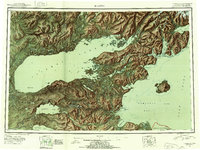
USGS Topo Quad Iliamna, Alaska
Download Iliamna
Download Iliamna
Southern Latitude:
59.0000 N
Eastern Longitude:
-153.0000
Northen Latitude:
60.0000 N
Western Longitude:
-156.0000
Abandoned Towns(s) in Iliamna
Chekok,
Chenik,
Hedlunds,
Kakhonak Bay,
Napaimute,
Archipelago(s) in Iliamna
Nordyke Islands,
The Toadstools,
Bar(s) in Iliamna
Augustine Rocks,
Black Reef,
Entrance Rock,
Glacier Spit,
Iniskin Rock,
Iniskin Shoal,
Juma Reef,
Oil Reef,
Turtle Reef,
Bay(s) in Iliamna
Akjemguiga Cove,
Akumwarvik Bay,
Amakdedulia Cove,
Bruin Bay,
Chekok Bay,
Chinitna Bay,
Copper River Bay,
Cottonwood Bay,
Dry Bay,
Durants Cove,
Eagle Bay,
Fox Bay,
Green Cove,
Horseshoe Cove,
Iliamna Bay,
Iniskin Bay,
Intricate Bay,
Kamishak Bay,
Knutson Bay,
Kokhanok Bay,
Leon Bay,
Lonesome Bay,
McNeil Cove,
Narrow Cove,
Northeast Bay,
Oil Bay,
Pedro Bay,
Pile Bay,
Pinkidulia Cove,
Reindeer Bay,
Right Arm Iniskin Bay,
Roadhouse Bay,
Rocky Cove,
Sid Larson Bay,
Snug Harbor,
Ursus Cove,
Whistlewing Bay,
Cape(s) in Iliamna
AC Point,
Burr Point,
Camp Point,
Chekok Point,
Chenik Head,
Chinitna Point,
Contact Point,
Diamond Point,
Iniskin Peninsula,
Knoll Head,
Lonesome Point,
McNeil Head,
Millets Point,
North Head,
Oil Point,
Sea Otter Point,
Seal Spit,
South Head,
Squirrel Point,
Tignagvik Point,
Tommy Point,
Ursus Head,
Channel(s) in Iliamna
Big Chutes,
City(s) in Iliamna
Newhalen,
Nondalton,
Cliff(s) in Iliamna
Eagle Bluff,
Fortification Bluff,
Glacier(s) in Iliamna
Roscoe Glacier,
Umbrella Glacier,
Hill(s) in Iliamna
Peters Plug,
Island(s) in Iliamna
Augustine Island,
Bear Island,
Big Island,
Big Rock,
Dog Island,
Eagle Bay Island,
Flat Island,
Grassy Island,
Hat Island,
Iniskin Island,
Jackrabbit Island,
McNeil Islet,
Mushroom Islands,
Nordyke Island,
Pomeroy Island,
Porcupine Island,
Rabbit Islands,
Reindeer Island,
Scott Island,
Seal Islands,
Shaw Island,
Shoulderblade Island,
Tenmile Island,
Triangle Island,
Twomile Island,
Vert Island,
White Gull Island,
Lake(s) in Iliamna
Alexcy Lake,
Battle Lake,
Beaver Lake,
Boot Lake,
Chekok Lake,
Chenik Lake,
Dumbbell Lake,
Emerald Lake,
Fog Lake,
Gibraltar Lake,
Grants Lagoon,
Iliamna Lake,
Iron Springs Lake,
Kirschner Lake,
Kokhanok Lake,
Kukaklek Lake,
Long Lake,
Lower Copper Lake,
Lower Tazimina Lake,
McNeil Lake,
Meadow Lake,
Mirror Lake,
Moose Lake,
Negro Lake,
Old Roadhouse Lake,
Pickerel Lakes,
Pike Lake,
Pike Lakes,
Pirate Lake,
Reindeer Lake,
Schoolhouse Lake,
Sixmile Lake,
Spectacle Lake,
Stonehouse Lake,
Summit Lakes,
Upper Copper Lake,
Venturi Lake,
Mountain(s) in Iliamna
Augustine Volcano,
Bald Hill,
Big Hill,
Big Mountain,
Brown Mountain,
Brown Peak,
Chenik Mountain,
Mount Chinitna,
The Cone,
Cy Peak,
Mount Eleanor,
Front Mountain,
Groundhog Mountain,
Horn Mountain,
Knub Hill,
Knutson Mountain,
Lookout Mountain,
Middle Mountain,
North Twin,
Pedro Mountain,
Pfaff Peak,
Pilot Knob,
Mount Pomeroy,
Range Peak,
Roadhouse Mountain,
Roscoe Peak,
Seven Sisters,
Shark Tooth Hill,
Sharp Mountain,
South Chinitna Mountain,
South Twin,
Sugarloaf Mountain,
Taq- Nust-in Mountain,
Tonnie Peak,
Park(s) in Iliamna
Katmai National Preserve,
Pass(s) in Iliamna
Portage Pass,
Range(s) in Iliamna
Back Range,
Ridge(s) in Iliamna
Havenstrite Ridge,
Step Mountain,
Three Sisters Mountain,
Tilted Hills,
River(s) in Iliamna
Chinitna River,
Copper River,
Douglas River,
Iliamna River,
Iniskin River,
Kamishak River,
Kokhanok River,
Little Kamishak River,
McNeil River,
Middle Fork Paint River,
Newhalen River,
Nonvianuk River,
North Fork Paint River,
Lake Fork Paint River,
Paint River,
Pile River,
South Fork Paint River,
Tazimina River,
Stream(s) in Iliamna
Amakdedori Creek,
Antitonnie Creek,
Bear Creek,
Beaver Creek,
Belinda Creek,
Blister Creek,
Bow Creek,
Bowser Creek,
Brown Creek,
Canyon Creek,
Chekok Creek,
Chinkelyes Creek,
Cirque Creek,
Clearwater Creek,
Cliff Creek,
Coffin Creek,
Covey Creek,
Crevice Creek,
Dam Creek,
Dennis Creek,
Dream Creek,
Dunuletak Creek,
Eagle Bay Creek,
Edelman Creek,
Fitz Creek,
Forky Creek,
Funnel Creek,
Gaikema Creek,
Griffin Creek,
Hardy Creek,
Holland Creek,
Horn Creek,
Irish Creek,
Kenty Creek,
Keystone Creek,
Knutson Creek,
Left Fork West Glacier Creek,
Low Creek,
Lower Talarik Creek,
Marsh Creek,
Middle Glacier Creek,
Mikfik Creek,
Moraine Creek,
Nanuktuk Creek,
Park Creek,
Paveloff Creek,
Pecks Creek,
Pete Andrews Creek,
Pomeroy Creek,
Portage Creek,
Ptarmigan Creek,
Rich Creek,
Right Arm Creek,
Right Branch,
Right Fork West Glacier Creek,
Roadhouse Creek,
Roscoe Creek,
Silver Creek,
Silver Salmon Creek,
Sinking Creek,
Slippery Creek,
Strike Creek,
Sulukpuk Creek,
Sunday Creek,
Tommy Creek,
Tonnie Creek,
Tooie Creek,
Trail Creek,
Twist Creek,
Upper Talarik Creek,
Well Creek,
West Glacier Creek,
Williams Creek,
Wrong Branch,
Wrong Branch Trail Creek,
Valley(s) in Iliamna
Knutson Valley,
Village(s) in Iliamna
Fish Village,
Igiugig,
Iliamna,
Iniskin,
Kokhanok,
Old Iliamna,
Pedro Bay,
Pile Bay Village,
Seversens,
Waterfall(s) in Iliamna
Cynthia Falls,
Petrof Falls,
