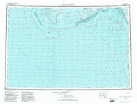
USGS Topo Quad Kuskokwim Bay, Alaska
Download Kuskokwim Bay
Download Kuskokwim Bay
Southern Latitude:
59.0000 N
Eastern Longitude:
-162.0000
Northen Latitude:
60.0000 N
Western Longitude:
-165.0000
Abandoned Towns(s) in Kuskokwim Bay
Chalit,
Bar(s) in Kuskokwim Bay
Carter Spit,
Bay(s) in Kuskokwim Bay
Carter Bay,
Kuskokwim Bay,
Cape(s) in Kuskokwim Bay
Cape Avinof,
Channel(s) in Kuskokwim Bay
Eek Channel,
Etolin Strait,
Kuskokwak Channel,
Kuskokwak Channel Kuskokwim Bay,
Warehouse Channel,
Warehouse Channel Kuskokwim Bay,
West Channel,
West Channel Kuskokwim Bay,
Cliff(s) in Kuskokwim Bay
Warehouse Bluff,
Island(s) in Kuskokwim Bay
Kikegtek Island,
Kwigluk Island,
Pingurbek Island,
Lake(s) in Kuskokwim Bay
Bow Lake,
River(s) in Kuskokwim Bay
Anohwahk River,
Ishkowik River,
Kinak River,
Kongnignanohk River,
Kuguklik River,
Kwigillingok River,
Sea(s) in Kuskokwim Bay
Bering Sea,
Stream(s) in Kuskokwim Bay
North Branch Warehouse Creek,
South Branch Warehouse Creek,
Tungak Creek,
Warehouse Creek,
Weelung Creek,
Village(s) in Kuskokwim Bay
Anogok,
Kipnuk,
Kongiganak,
Kulvagavik,
Kwigillingok,
