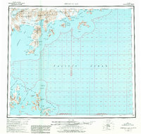
USGS Topo Quad Stepovak Bay, Alaska
Download Stepovak Bay
Download Stepovak Bay
Southern Latitude:
55.0000 N
Eastern Longitude:
-158.0000
Northen Latitude:
56.0000 N
Western Longitude:
-160.0000
Abandoned Towns(s) in Stepovak Bay
Mitrofania,
Archipelago(s) in Stepovak Bay
Chiachi Islands,
Bar(s) in Stepovak Bay
Gull Rocks,
Bay(s) in Stepovak Bay
Anchor Bay,
Boulder Bay,
Chiachi Bay,
East Bight,
Fairweather Bay,
Fish Ranch Bay,
Fishrack Bay,
Flying Eagle Harbor,
Fox Bay,
Grub Gulch,
Herring Lagoon,
Humpback Bay,
Island Bay,
Ivanof Bay,
The Kitchen,
Kupreanof Harbor,
Larsen Bay,
Mist Harbor,
Mitrofania Bay,
Mitrofania Harbor,
Northeast Bight,
Northeast Harbor,
Northwest Harbor,
Ramsey Bay,
Sandy Cove,
Shoal Bay,
Sosbee Bay,
Stepovak Bay,
Yukon Harbor,
Beach(s) in Stepovak Bay
Long Beach,
Cape(s) in Stepovak Bay
Alexander Point,
Bluff Point,
Cape Ikti,
Cape Thompson,
Cape Wedge,
Coal Cape,
Coal Point,
Cub Point,
Dent Point,
Dome Point,
Entrance Point,
Fox Cape,
Kuniguigan,
Kupreanof Peninsula,
Kupreanof Point,
Noon Point,
Seal Cape,
Stirni Point,
Three Star Point,
Channel(s) in Stepovak Bay
East Nagai Strait,
Koniuji Strait,
West Nagai Strait,
Cliff(s) in Stepovak Bay
Rock Wall,
Flat(s) in Stepovak Bay
Stepanof Flats,
Island(s) in Stepovak Bay
Atkins Island,
Bendel Island,
Big Koniuji Island,
Brother Islands,
Castle Rock,
Chiachi Island,
Egg Island,
Hall Island,
Herendeen Island,
Jacob Island,
James Island,
Leader Island,
Little Koniuji Island,
Mitrofania Island,
Murre Rocks,
Pad Island,
Paul Island,
Peninsula Island,
Petrel Island,
Pinnacle Rock,
Pinusuk Island,
Porpoise Rocks,
Road Island,
Shag Rock,
Shapka Island,
Spectacle Island,
Spitz Island,
Turner Island,
Mountain(s) in Stepovak Bay
Hag Peak,
Lookout Hill,
Red Bluff Mountain,
Red Hill,
Pass(s) in Stepovak Bay
Granville Portage,
River(s) in Stepovak Bay
Big River,
Ivanof River,
Kametolook River,
Stream(s) in Stepovak Bay
Humpback Creek,
Osterback Creek,
Red Bluff Creek,
Valley(s) in Stepovak Bay
Smoky Hollow,
Village(s) in Stepovak Bay
Ivanof Bay,
Perryville,
