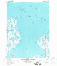
USGS Topo Quad Barrow A-2, Alaska
Download Barrow A-2
Download Barrow A-2
Southern Latitude:
71.0000 N
Eastern Longitude:
-155.1000
Northen Latitude:
71.2500 N
Western Longitude:
-155.7000
Bay(s) in Barrow A-2
Kurgorak Bay,
Cape(s) in Barrow A-2
Black Head,
Christie Point,
Channel(s) in Barrow A-2
Dease Inlet,
Sanigaruak Pass,
Cliff(s) in Barrow A-2
Kachiksuk Bluffs,
Island(s) in Barrow A-2
Cooper Island,
Igalik Island,
Martin Island,
Sanigaruak Island,
Tiny Island,
