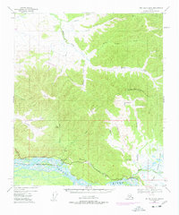
USGS Topo Quad Big Delta B-5, Alaska
Download Big Delta B-5
Download Big Delta B-5
Southern Latitude:
64.2500 N
Eastern Longitude:
-146.0000
Northen Latitude:
64.5000 N
Western Longitude:
-146.5000
Lake(s) in Big Delta B-5
Shaw Pond,
Locale(s) in Big Delta B-5
Tenderfoot,
Stream(s) in Big Delta B-5
Banner Creek,
Buckeye Creek,
Canyon Creek,
Caribou Creek,
Delta Creek,
Democrat Creek,
Gold Run,
Keystone Creek,
Lenant Creek,
Minton Creek,
Monte Cristo Creek,
Rosa Creek,
Shaw Creek,
Tenderfoot Creek,
Uncle Sam Creek,
Village(s) in Big Delta B-5
Richardson,
