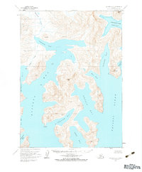
USGS Topo Quad Chignik A-2, Alaska
Download Chignik A-2
Download Chignik A-2
Southern Latitude:
56.0000 N
Eastern Longitude:
-158.3333
Northen Latitude:
56.2500 N
Western Longitude:
-158.6667
Bay(s) in Chignik A-2
Devils Bay,
Fishhook Bay,
Kuiukta Bay,
Necessity Cove,
Northwest Arm Castle Bay,
Portage Bay,
Ross Cove,
Seal Bay,
Sweater Bay,
Warner Bay,
Windy Bay,
Mountain(s) in Chignik A-2
Chignik Mountain,
Ship Mountain,
Virgin Peak,
Stream(s) in Chignik A-2
Spoon Creek,
