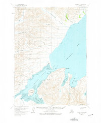
USGS Topo Quad Chignik B-2, Alaska
Download Chignik B-2
Download Chignik B-2
Southern Latitude:
56.2500 N
Eastern Longitude:
-158.3333
Northen Latitude:
56.5000 N
Western Longitude:
-158.6667
Bar(s) in Chignik B-2
Chignik Spit,
Bay(s) in Chignik B-2
Anchorage Bay,
Boomers Cove,
Chignik Lagoon,
Mallard Duck Bay,
Mud Bay,
Mud Hole,
Schooner Bay,
Cape(s) in Chignik B-2
Browns Point,
Diamond Point,
Green Point,
Hume Point,
Jerrys Point,
Mensis Point,
Packers Point,
Pilerack Point,
Rabbit Point,
Rocky Point,
City(s) in Chignik B-2
Chignik,
Cliff(s) in Chignik B-2
Chignik Head,
Negro Head,
Dam(s) in Chignik B-2
Alaska Packers Association Chignik Dam,
Columbia Wards Fisheries Incorporated Dam,
Peter Pan Seafoods Chignik Dam,
Flat(s) in Chignik B-2
Chignik Flats,
Island(s) in Chignik B-2
Chignik Island,
Eagle Rock,
Three Sisters Rock,
River(s) in Chignik B-2
Chignik River,
Stream(s) in Chignik B-2
Alfred Creek,
Dago Frank Creek,
Dry Creek,
Marshinlak Creek,
Metrofania Creek,
Neketa Creek,
Old Ladies Creek,
Packers Creek,
Parallel Creek,
Thompson Creek,
Through Creek,
Whalers Creek,
Valley(s) in Chignik B-2
McKinsey Valley,
Thompson Valley,
Village(s) in Chignik B-2
Chignik Lagoon,
