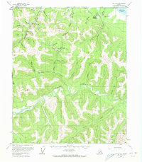
USGS Topo Quad Circle B-2, Alaska
Download Circle B-2
Download Circle B-2
Southern Latitude:
65.2500 N
Eastern Longitude:
-144.5000
Northen Latitude:
65.5000 N
Western Longitude:
-145.0000
Bar(s) in Circle B-2
Pitkas Bar,
City(s) in Circle B-2
Circle Hot Springs,
Lake(s) in Circle B-2
Medicine Lake,
Mountain(s) in Circle B-2
Ketchem Dome,
River(s) in Circle B-2
Mary Louise Fork,
Stream(s) in Circle B-2
Bottom Dollar Creek,
Buckley Bar Creek,
Fifteen Pup,
Greenhorn Creek,
Half Dollar Creek,
Harrison Creek,
Holdem Creek,
Hot Springs Creek,
Nine Pup,
Portage Creek,
Portage Creek,
Sheep Creek,
Sixteen Pup,
Squaw Creek,
Switch Creek,
Tommys Pup,
Traverse Creek,
Twenty-five Pup,
Twenty-six Pup,
Twenty-two Pup,
Two-bit Creek,
Valley(s) in Circle B-2
Discovery Gulch,
Nugget Gulch,
Ptarmigan Gulch,
Village(s) in Circle B-2
Circle Hot Springs Station,
