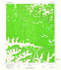
USGS Topo Quad Circle C-3, Alaska
Download Circle C-3
Download Circle C-3
Southern Latitude:
65.5000 N
Eastern Longitude:
-145.0000
Northen Latitude:
65.7500 N
Western Longitude:
-145.5000
Mountain(s) in Circle C-3
Boulder Hill,
Stream(s) in Circle C-3
Bear Creek,
Bedrock Creek,
Bonanza Creek,
Cache Creek,
Deception Pup,
Independence Creek,
Mammoth Creek,
Mastodon Creek,
Miller Creek,
Porcupine Creek,
Sawpit Creek,
Stack Pup,
Upper Rock Creek,
Wedgewood Creek,
Westover Creek,
Willow Creek,
Yankee Creek,
Valley(s) in Circle C-3
Caribou Gulch,
Granite Gulch,
Grognon Gulch,
Village(s) in Circle C-3
Miller House,
