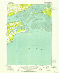
USGS Topo Quad Cordova B-6, Alaska
Download Cordova B-6
Download Cordova B-6
Southern Latitude:
60.2500 N
Eastern Longitude:
-145.8750
Northen Latitude:
60.5000 N
Western Longitude:
-146.2500
Bar(s) in Cordova B-6
Government Rock,
Shag Rock,
Twin Rocks,
Bay(s) in Cordova B-6
Boswell Bay,
Hartney Bay,
Kenny Cove,
Cape(s) in Cordova B-6
Point Bentinck,
Point Steele,
Point Whitshed,
Big Point,
Gravel Point,
Shirttail Point,
Channel(s) in Cordova B-6
Strawberry Channel,
Hill(s) in Cordova B-6
Strawberry Hill,
Island(s) in Cordova B-6
Mummy Island,
Boswell Rock,
Little Mummy Island,
Pinnacle Rock,
Stream(s) in Cordova B-6
Fish Creek,
Palugvik Creek,
Snake Creek,
Village(s) in Cordova B-6
Boswell Bay,
Whitshed,
