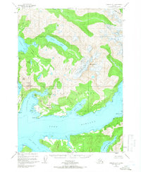
USGS Topo Quad Cordova D-7, Alaska
Download Cordova D-7
Download Cordova D-7
Southern Latitude:
60.7500 N
Eastern Longitude:
-146.2500
Northen Latitude:
61.0000 N
Western Longitude:
-146.6250
Basin(s) in Cordova D-7
Gumboot Basin,
Bay(s) in Cordova D-7
Port Fidalgo,
Fish Bay,
Irish Cove,
The Lagoon,
Landlocked Bay,
Saint Matthews Bay,
Two Moon Bay,
Cape(s) in Cordova D-7
Copper Mountain Peninsula,
Graveyard Point,
Glacier(s) in Cordova D-7
Glacier G213687E60954N,
Glacier G213708E60993N,
Glacier G213722E60985N,
Glacier G213749E60966N,
Silver Glacier,
Lake(s) in Cordova D-7
Copper Lake,
Millard Lake,
Silver Lake,
Mountain(s) in Cordova D-7
Bells Butte,
Billygoat Mountain,
Copper Mountain,
Mount Denson,
River(s) in Cordova D-7
Duck River,
Stream(s) in Cordova D-7
Banzer Creek,
Chisna Creek,
Copper Creek,
Horsetail Falls Creek,
Lagoon Creek,
Millard Creek,
Reynolds Creek,
Valley(s) in Cordova D-7
Vesuvius Valley,
