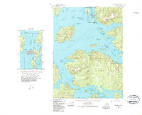
USGS Topo Quad Craig B-4, Alaska
Download Craig B-4
Download Craig B-4
Southern Latitude:
55.2500 N
Eastern Longitude:
-133.0000
Northen Latitude:
55.5000 N
Western Longitude:
-133.3333
Bar(s) in Craig B-4
Balandra Shoal,
Ballena Island Shoal,
Fern Reef,
Fish Egg Reef,
Bay(s) in Craig B-4
Port Saint Nicholas,
Port Refugio,
Port Estrella,
Port Bagial,
Port Caldera,
Adrian Cove,
Big Bay,
Crab Bay,
Doyle Bay,
Shelter Cove,
Trocadero Bay,
Cape(s) in Craig B-4
Point Cuerbo,
Point Bocas,
Point Batan,
Point Iphigenia,
Point Lomas,
Point Eugenia,
Point Miliflores,
Point Miraballes,
Point Providence,
Agueda Point,
Canoe Point,
Cape Cambon,
Cape Empinado,
Cape Flores,
Cape Suspiro,
Diamond Point,
Perlas Point,
Punta de los Almos,
Punta De los Islotillos,
Punta Gorda,
Punta Maria Antonia,
Punta Noriega,
Punta Palmito,
Point San Antonio,
Tranquil Point,
Turn Point,
Point Verde,
Channel(s) in Craig B-4
Tlevak Narrows,
Ulloa Channel,
Ursua Channel,
City(s) in Craig B-4
Craig,
Dam(s) in Craig B-4
Craig Water Supply Dam,
Waterfall Dam,
Island(s) in Craig B-4
Balandra Island,
Ballena Islands,
Block Island,
Bush Islets,
Canas Island,
Cole Island,
Coronados Islands,
Craig Island,
Culebrina Island,
Fish Egg Island,
Isla Buen Ayre,
Joe Island,
Ladrones Islands,
Madre de Dios Island,
Meares Island,
Midway Island,
Rancheria Island,
Ridge Island,
San Adrian Island,
San Juan Bautista Island,
San Juanito Island,
Shaft Rock,
Shelikof Island,
Toti Island,
Ulloa Island,
Unlucky Island,
Verde Island,
Lake(s) in Craig B-4
Waterfall Reservoir,
Mountain(s) in Craig B-4
Bautista Peak,
Sunny Hay Mountain,
Stream(s) in Craig B-4
Crab Creek,
Trail(s) in Craig B-4
Canoe Point Trail,
Village(s) in Craig B-4
Waterfall,
