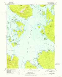
USGS Topo Quad Craig C-5, Alaska
Download Craig C-5
Download Craig C-5
Southern Latitude:
55.5000 N
Eastern Longitude:
-133.3333
Northen Latitude:
55.7500 N
Western Longitude:
-133.6667
Archipelago(s) in Craig C-5
Blanquizal Islands,
Dome Islets,
Harmony Islands,
Maurelle Islands,
Bar(s) in Craig C-5
Beta Rock,
Curacao Reef,
Desconocida Reef,
Kabanof Rocks,
Moke Rock,
Bay(s) in Craig C-5
Aguirre Bay,
Anguilla Bay,
Garcia Cove,
Gulf of Esquibel,
Nagasay Cove,
Nossuk Bay,
Salt Lake Bay,
Steamboat Bay,
Tonowek Bay,
Warm Chuck Inlet,
Cape(s) in Craig C-5
Point Desconocida,
Point Garcia,
Point Marabilla,
Point Delgada,
Point Animas,
Point Aguirre,
Point San Francisco,
Point San Pasqual,
Point Santa Gertrudis,
Point Santa Lucia,
Point Santa Rosalia,
Point Incarnation,
Bay Point,
Blanquizal Point,
Bobs Point,
Dead Tree Point,
Palisade Point,
Snail Point,
Steamboat Point,
Channel(s) in Craig C-5
Arriaga Passage,
Bocas De Finas,
Launch Passage,
San Christoval Channel,
Sonora Passage,
Cliff(s) in Craig C-5
Derrumba Ridge,
Tonowek Ridge,
White Cliff,
Island(s) in Craig C-5
Abrejo Rocks,
Alargate Rocks,
Anguilla Island,
Animas Island,
Bushtop Island,
Caracol Island,
Culebra Islands,
East San Lorenzo Island,
Escurial Island,
Esquibel Island,
Flotilla Island,
Garcia Island,
Garita Rock,
Hacha Island,
Hermagos Islands,
Kubanof Rock,
Lambda Rock,
Marabilla Island,
Palisade Island,
Pesquera Island,
Phillips Rock,
Princesa Island,
Quitasueno Rock,
Saint Philip Island,
San Fernando Island,
San Lorenzo Islands,
Santa Lucia Island,
Sonora Island,
Tonina Island,
Toza Island,
Trasera Island,
Turtle Island,
Twocrack Island,
West San Lorenzo Island,
Mountain(s) in Craig C-5
Bald Mountain,
Noyes Peak,
Timber Knob,
