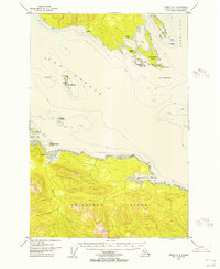
USGS Topo Quad Juneau A-4, Alaska
Download Juneau A-4
Download Juneau A-4
Southern Latitude:
58.0000 N
Eastern Longitude:
-135.0000
Northen Latitude:
58.2500 N
Western Longitude:
-135.3333
Bar(s) in Juneau A-4
Sisters Reef,
Bay(s) in Juneau A-4
Spasski Bay,
Swanson Harbor,
Whitestone Harbor,
Cape(s) in Juneau A-4
Point Couverden,
Neck Point,
Cliff(s) in Juneau A-4
No Use Ledge,
Sharp Ledge,
Island(s) in Juneau A-4
Ansley Island,
Couverden Island,
Couverden Rock,
Entrance Island,
Pulizzi Island,
Rocky Island,
The Sisters,
Spasski Island,
Mountain(s) in Juneau A-4
Elephant Mountain,
Stream(s) in Juneau A-4
Spasski Creek,
Suntaheen Creek,
