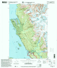
USGS Topo Quad Juneau C-3, Alaska
Download Juneau C-3
Download Juneau C-3
Southern Latitude:
58.5000 N
Eastern Longitude:
-134.6667
Northen Latitude:
58.7500 N
Western Longitude:
-135.0000
Abandoned Towns(s) in Juneau C-3
Amalga,
Bar(s) in Juneau C-3
Poundstone Rock,
Basin(s) in Juneau C-3
Cottrell Basin,
Yankee Basin,
Bay(s) in Juneau C-3
Berners Bay,
Bridget Cove,
Echo Cove,
Yankee Cove,
Beach(s) in Juneau C-3
Eagle Beach,
Cape(s) in Juneau C-3
Point Bridget,
Glacier(s) in Juneau C-3
Eagle Glacier,
Island(s) in Juneau C-3
Benjamin Island,
Gull Island,
Mab Island,
North Island,
Sentinel Island,
Lake(s) in Juneau C-3
Windfall Lake,
Mine(s) in Juneau C-3
Aurora Borealis Mine,
Bessie Mine,
Eagle River Mine,
Mountain(s) in Juneau C-3
Mount Adolph Knopf,
Thane Mountain,
River(s) in Juneau C-3
Eagle River,
Herbert River,
Stream(s) in Juneau C-3
Bessie Creek,
Boulder Creek,
Canyon Creek,
Cowee Creek,
Davies Creek,
Sawmill Creek,
South Fork Cowee Creek,
Windfall Creek,
Trail(s) in Juneau C-3
Amalga Trail,
Bessie Creek Trail,
Davies Creek Trail,
Herbert Glacier Trail,
Point Bridget Trail,
Windfall Lake Trail,
Yankee Basin Trail,
