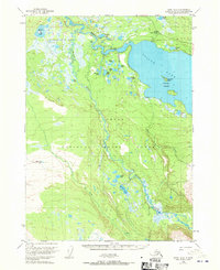
USGS Topo Quad Kenai B-2, Alaska
Download Kenai B-2
Download Kenai B-2
Southern Latitude:
60.2500 N
Eastern Longitude:
-150.3750
Northen Latitude:
60.5000 N
Western Longitude:
-150.7500
Island(s) in Kenai B-2
Caribou Island,
Frying Pan Island,
Lake(s) in Kenai B-2
Blizzard Lake,
Browns Lake,
Fire Lake,
Frisbee Lake,
Harvey Lake,
Horse Trail Lake,
Hunters Lake,
Kaknu Lake,
Olson Lake,
Round Lake,
Sahot Lake,
Swan Lake,
Tea Lake,
Torpedo Lake,
River(s) in Kenai B-2
Killey River,
Stream(s) in Kenai B-2
King County Creek,
Olson Creek,
