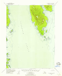
USGS Topo Quad Ketchikan A-6, Alaska
Download Ketchikan A-6
Download Ketchikan A-6
Southern Latitude:
55.0000 N
Eastern Longitude:
-131.6667
Northen Latitude:
55.2500 N
Western Longitude:
-132.0000
Area(s) in Ketchikan A-6
Point McCartey,
Bar(s) in Ketchikan A-6
Phocena Rocks,
Bay(s) in Ketchikan A-6
Port Johnson,
Bostwick Inlet,
Chichagof Bay,
Dall Bay,
Nehenta Bay,
Nelson Cove,
Open Bay (not official),
Phocana Bay,
Phocena Bay,
Seal Cove,
Cape(s) in Ketchikan A-6
Point McCartey,
Adams Point,
Bostwick Point,
Dall Head,
Rip Point,
Windy Point,
Island(s) in Ketchikan A-6
Bronaugh Islands,
Grouse Rock,
Moira Rock,
Polk Island,
Seal Cove Rocks,
Sun Rocks,
Wedge Island,
Wedge Islands,
Whiterock Island,
Lake(s) in Ketchikan A-6
Downdraft Lake,
Mountain(s) in Ketchikan A-6
Chapin Peak,
Flat Mountain,
Punch Hill,
The Puppets,
Park(s) in Ketchikan A-6
Dall Bay State Marine Park,
Pass(s) in Ketchikan A-6
Nichols Passage,
Stream(s) in Ketchikan A-6
Halibut Creek,
