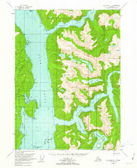
USGS Topo Quad Ketchikan C-3, Alaska
Download Ketchikan C-3
Download Ketchikan C-3
Southern Latitude:
55.5000 N
Eastern Longitude:
-130.6667
Northen Latitude:
55.7500 N
Western Longitude:
-131.0000
Bay(s) in Ketchikan C-3
Ella Bay,
Grace Cove,
Manzanita Bay,
Punchbowl Cove,
Rudyerd Bay,
Sargent Bay,
Walker Cove,
Cape(s) in Ketchikan C-3
Point Eva,
Point Louise,
Cactus Point,
Hut Point,
Ledge Point,
Skirt Point,
Tramp Point,
Wart Point,
Island(s) in Ketchikan C-3
Manzanita Island,
New Eddystone Islands,
New Eddystone Rock,
Snip Islands,
Lake(s) in Ketchikan C-3
Lake Manzoni,
Nooya Lake,
Punchbowl Lake,
Stream(s) in Ketchikan C-3
Fromholtz Creek,
Fromholz Creek,
Grace Creek,
Granite Creek,
Manzanita Creek,
