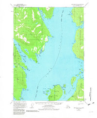
USGS Topo Quad Ketchikan C-6, Alaska
Download Ketchikan C-6
Download Ketchikan C-6
Southern Latitude:
55.5000 N
Eastern Longitude:
-131.6667
Northen Latitude:
55.7500 N
Western Longitude:
-132.0000
Archipelago(s) in Ketchikan C-6
Tatoosh Islands,
Area(s) in Ketchikan C-6
Tatoosh Rocks,
Bar(s) in Ketchikan C-6
Bittersweet Rock,
Bay(s) in Ketchikan C-6
Port Stewart,
Bond Bay,
Bushy Point Cove,
Francis Cove,
Helm Bay,
Raymond Cove,
Smugglers Cove,
Wadding Cove,
Cape(s) in Ketchikan C-6
Point Francis,
Betton Point,
Bushy Point,
Escape Point,
Helm Point,
Indian Point,
Mike Point,
Tatoosh Point,
Channel(s) in Ketchikan C-6
Clover Passage,
Island(s) in Ketchikan C-6
Back Island,
Betton Island,
Cache Island,
Cedar Island,
Forss Island,
Grant Island,
Hump Island,
Joe Island,
Moser Island,
Stack Island,
Thomas Island,
Trunk Island,
Lake(s) in Ketchikan C-6
Cessnun Lakes,
Helm Lake,
Mine(s) in Ketchikan C-6
Alaska Gold Mountain Mines,
Gold Standard Mine,
Steers Mine,
Mountain(s) in Ketchikan C-6
Betton Head,
Gold Mountain,
Mount Marr,
Stream(s) in Ketchikan C-6
Falls Creek,
Granite Creek,
Lunch Creek,
Smugglers Creek,
Walker Creek,
