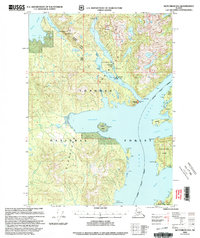
USGS Topo Quad Ketchikan D-6, Alaska
Download Ketchikan D-6
Download Ketchikan D-6
Southern Latitude:
55.7500 N
Eastern Longitude:
-131.6667
Northen Latitude:
56.0000 N
Western Longitude:
-132.0000
Abandoned Towns(s) in Ketchikan D-6
Yes Bay,
Bay(s) in Ketchikan D-6
Convenient Cove,
Neets Bay,
Santa Anna Inlet,
Spacious Bay,
Sunny Bay,
Yes Bay,
Cape(s) in Ketchikan D-6
Point Santa Anna,
Bluff Point,
Brow Point,
Chin Point,
Heckman Point,
Indian Point,
Nose Point,
Snail Point,
Syble Point,
Island(s) in Ketchikan D-6
Gedney Island,
Square Island,
Lake(s) in Ketchikan D-6
Lake Helen,
Lake McDonald,
Mountain(s) in Ketchikan D-6
Bald Mountain,
Table Mountain,
Twin Rift,
Pass(s) in Ketchikan D-6
Gedney Pass,
Stream(s) in Ketchikan D-6
Walker Creek,
Wasta Creek,
Wolverine Creek,
