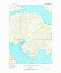
USGS Topo Quad Kodiak B-3, Alaska
Download Kodiak B-3
Download Kodiak B-3
Southern Latitude:
57.2500 N
Eastern Longitude:
-152.6667
Northen Latitude:
57.5000 N
Western Longitude:
-153.0000
Abandoned Towns(s) in Kodiak B-3
Eagle Harbor,
Kiliuda,
Bar(s) in Kodiak B-3
Kiliuda Rock,
Bay(s) in Kodiak B-3
Boulder Bay,
Eagle Harbor,
Kiliuda Bay,
Saltery Cove,
Santa Flavia Bay,
Shearwater Bay,
Ugak Bay,
Cape(s) in Kodiak B-3
Bluff Point,
Dangerous Cape,
Ermine Point,
Inner Right Cape,
Left Cape,
Observation Point,
Outer Right Cape,
Pillar Point,
Shearwater Point,
Island(s) in Kodiak B-3
Dusk Islands,
Ladder Island,
Nest Island,
Stream(s) in Kodiak B-3
Pillar Creek,
