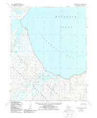
USGS Topo Quad Kotzebue A-4, Alaska
Download Kotzebue A-4
Download Kotzebue A-4
Southern Latitude:
66.0000 N
Eastern Longitude:
-163.5000
Northen Latitude:
66.2500 N
Western Longitude:
-164.0000
Bay(s) in Kotzebue A-4
Goodhope Bay,
River(s) in Kotzebue A-4
Cripple River,
Goodhope River,
Pish River,
Stream(s) in Kotzebue A-4
Clifford Creek,
Eagle Creek,
Fox Creek,
Francis Creek,
Lava Creek,
Pot Creek,
