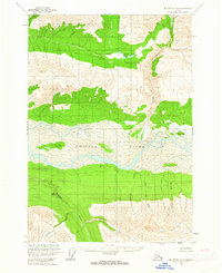
USGS Topo Quad McCarthy A-4, Alaska
Download McCarthy A-4
Download McCarthy A-4
Southern Latitude:
61.0000 N
Eastern Longitude:
-142.1250
Northen Latitude:
61.2500 N
Western Longitude:
-142.5000
Island(s) in McCarthy A-4
Bear Island,
Lake(s) in McCarthy A-4
Big Bend Lakes,
Mountain(s) in McCarthy A-4
Bryson Bar,
Park(s) in McCarthy A-4
Wrangell-Saint Elias National Park,
River(s) in McCarthy A-4
East Fork Kiagna River,
Stream(s) in McCarthy A-4
Bearhole Creek,
Canyon Creek,
Cave Creek,
Clear Stream,
Coffee Creek,
Discovery Creek,
Doby Creek,
Erickson Creek,
McCurdy Creek,
Sheep Creek,
