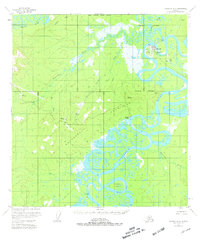
USGS Topo Quad McGrath D-6, Alaska
Download McGrath D-6
Download McGrath D-6
Southern Latitude:
62.7500 N
Eastern Longitude:
-155.5000
Northen Latitude:
63.0000 N
Western Longitude:
-156.0000
Area(s) in McGrath D-6
K-esh Dzochak-,
City(s) in McGrath D-6
McGrath,
Island(s) in McGrath D-6
Harrell Island,
Lake(s) in McGrath D-6
Wilson Lake,
Locale(s) in McGrath D-6
Wilsons,
Mine(s) in McGrath D-6
Candle Placer,
Mountain(s) in McGrath D-6
Roundabout Mountain,
Range(s) in McGrath D-6
Candle Hills,
Roundabout Mountains,
River(s) in McGrath D-6
Katlitna River,
Takotna River,
Tatalina River,
Stream(s) in McGrath D-6
Camp Creek,
Candle Creek,
Carl Creek,
Cash Creek,
Rex Creek,
Village(s) in McGrath D-6
Old McGrath,
