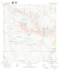
USGS Topo Quad Mount Hayes A-5, Alaska
Download Mount Hayes A-5
Download Mount Hayes A-5
Southern Latitude:
63.0000 N
Eastern Longitude:
-146.0000
Northen Latitude:
63.2500 N
Western Longitude:
-146.5000
Lake(s) in Mount Hayes A-5
Basalt Lake,
Downwind Lake,
Glacier Gap Lake,
Landmark Gap Lake,
Osar Lake,
Phalarope Lake,
Sevenmile Lake,
Tangle Lakes,
Upper Tangle Lake,
Mountain(s) in Mount Hayes A-5
Maclaren Summit,
Pass(s) in Mount Hayes A-5
Glacier Gap,
Landmark Gap,
Range(s) in Mount Hayes A-5
Amphitheater Mountains,
Ridge(s) in Mount Hayes A-5
Whistle Ridge,
River(s) in Mount Hayes A-5
Tangle River,
Stream(s) in Mount Hayes A-5
Rock Creek,
Valley(s) in Mount Hayes A-5
High Valley,
Houseblock Valley,
Tarn Valley,
