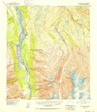
USGS Topo Quad Mount Hayes C-4, Alaska
Download Mount Hayes C-4
Download Mount Hayes C-4
Southern Latitude:
63.5000 N
Eastern Longitude:
-145.5000
Northen Latitude:
63.7500 N
Western Longitude:
-146.0000
Glacier(s) in Mount Hayes C-4
Riley Creek Glacier,
Lake(s) in Mount Hayes C-4
Backdown Lake,
Coal Mine Number 5 Lake,
Dicks Pond,
Kenna Lake,
Kens Pond,
Last Lake,
Pauls Pond,
Rangeview Lake,
Rapids Lake,
Mountain(s) in Mount Hayes C-4
Buffalo Dome,
Rapids(s) in Mount Hayes C-4
Black Rapids,
Stream(s) in Mount Hayes C-4
Bear Creek,
Camp Terry Creek,
Darling Creek,
Falls Creek,
Gunnysack Creek,
Little Gold Creek,
McCumber Creek,
MJ Creek,
Morningstar Creek,
Old Channel Creek,
Onemile Creek,
Riley Creek,
Ruby Creek,
Sargent Creek,
Trail(s) in Mount Hayes C-4
Trans-Alaska Trail - Black Rapids to Delta Junction,
Village(s) in Mount Hayes C-4
Donnelly,
