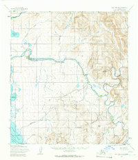
USGS Topo Quad Point Hope B-2, Alaska
Download Point Hope B-2
Download Point Hope B-2
Southern Latitude:
68.2500 N
Eastern Longitude:
-165.6000
Northen Latitude:
68.5000 N
Western Longitude:
-166.2000
Hill(s) in Point Hope B-2
Igilerak Hill,
Lake(s) in Point Hope B-2
Lake Makpik,
Tusikpak Lake,
Mountain(s) in Point Hope B-2
Kayaksak Mountain,
Mount Niaktuvik,
Ogsachak Mountain,
Range(s) in Point Hope B-2
Kemegrak Hills,
River(s) in Point Hope B-2
Ipewik River,
Stream(s) in Point Hope B-2
Angmakrok Creek,
Iglupak Creek,
Igruivotalik Creek,
Ilikrak Creek,
Ilyirak Creek,
Kokirat Creek,
Kugirarok Creek,
Nalakachak Creek,
Ogsachak Creek,
Phosphorite Creek,
Taktelak Creek,
