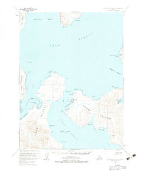
USGS Topo Quad Port Moller B-2, Alaska
Download Port Moller B-2
Download Port Moller B-2
Southern Latitude:
55.2500 N
Eastern Longitude:
-160.3333
Northen Latitude:
55.5000 N
Western Longitude:
-160.6667
Bar(s) in Port Moller B-2
Caton Shoal,
Popof Reef,
Unga Reef,
Weedy Shoals,
Bay(s) in Port Moller B-2
Ben Green Bight,
Coal Harbor,
Fox Hole,
Humboldt Harbor,
Lumber Bay,
Mud Bay,
Pirate Cove,
Red Cove,
Simeon Bay,
Zachary Bay,
Cape(s) in Port Moller B-2
Cross Cape,
Danger Point,
East Head,
Hardscratch Point,
North Head,
Quartz Point,
Sand Point,
Swedania Point,
West Head,
Channel(s) in Port Moller B-2
Popof Strait,
Unga Strait,
Cliff(s) in Port Moller B-2
White Bluff,
Dam(s) in Port Moller B-2
New England Fish Company Dam Sand Point,
Island(s) in Port Moller B-2
Arch Rock,
Egg Island,
Gull Island,
Henderson Island,
Little Egg Island,
Popof Island,
Range Island,
Range Islet,
Round Island,
Village(s) in Port Moller B-2
Sand Point,
