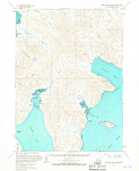
USGS Topo Quad Port Moller C-2, Alaska
Download Port Moller C-2
Download Port Moller C-2
Southern Latitude:
55.5000 N
Eastern Longitude:
-160.3333
Northen Latitude:
55.7500 N
Western Longitude:
-160.6667
Bay(s) in Port Moller C-2
Balboa Bay,
Dorenoi Bay,
San Diego Bay,
Cape(s) in Port Moller C-2
Monolith Point,
Reef Point,
Renshaw Point,
Island(s) in Port Moller C-2
Ballast Island,
Basset Island,
Guillemot Island,
Stream(s) in Port Moller C-2
Bishop Creek,
Coleman Creek,
Johnson Creek,
Lawrence Creek,
Valley(s) in Port Moller C-2
Grass Valley,
Lawrence Valley,
Portage Valley,
