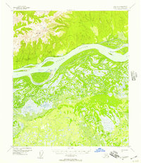
USGS Topo Quad Ruby D-4, Alaska
Download Ruby D-4
Download Ruby D-4
Southern Latitude:
64.7500 N
Eastern Longitude:
-154.5000
Northen Latitude:
65.0000 N
Western Longitude:
-155.0000
Abandoned Towns(s) in Ruby D-4
Soonkakat,
Cape(s) in Ruby D-4
Lone Tree Point,
Cliff(s) in Ruby D-4
White Cliffs,
Island(s) in Ruby D-4
Dasha Island,
Emerald Island,
Fox Island,
Ham Island,
Hardluck Island,
Kit Island,
Mickey Island,
Lake(s) in Ruby D-4
June Lake,
Kinakhulantan Lake,
Windmill Lake,
River(s) in Ruby D-4
Hardluck Slough,
Twin Slough,
Slough(s) in Ruby D-4
Hot Springs Slough,
Junekaket Slough,
Stream(s) in Ruby D-4
Junekaket Creek,
Ukawutni Creek,
Victor Slough,
Village(s) in Ruby D-4
Kokrines,
