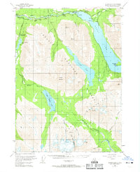
USGS Topo Quad Seward B-8, Alaska
Download Seward B-8
Download Seward B-8
Southern Latitude:
60.2500 N
Eastern Longitude:
-149.6250
Northen Latitude:
60.5000 N
Western Longitude:
-150.0000
City(s) in Seward B-8
Cooper Landing,
Dam(s) in Seward B-8
Cooper Lake Dam,
Fictional Place(s) in Seward B-8
Mystery,
Island(s) in Seward B-8
Porcupine Island,
Lake(s) in Seward B-8
Cooper Lake,
Lower Russian Lake,
Rainbow Lake,
Upper Russian Lake,
Mountain(s) in Seward B-8
Cecil Rhode Mountain,
Cooper Mountain,
Helen Rhode Mountain,
Noel Hanson Mountain,
Peak(s) in Seward B-8
Helen Rhode,
Stream(s) in Seward B-8
Bean Creek,
Boulder Creek,
Cooper Creek,
Crescent Creek,
Dry Creek,
Juneau Creek,
Moose Creek,
Placer Creek,
Porcupine Creek,
Quartz Creek,
Shackleford Creek,
Stetson Creek,
Summit Creek,
Trail(s) in Seward B-8
Bean Creek Trail,
Cooper Lake Trail (historical),
Resurrection River Trail,
Russian Lakes Trail,
Schooner Bend Trail,
Stetson Creek Trail,
Village(s) in Seward B-8
Snug Harbor,
