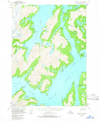
USGS Topo Quad Seward C-4, Alaska
Download Seward C-4
Download Seward C-4
Southern Latitude:
60.5000 N
Eastern Longitude:
-148.1250
Northen Latitude:
60.7500 N
Western Longitude:
-148.5000
Bay(s) in Seward C-4
Port Nellie Juan,
Cochrane Bay,
East Finger Inlet,
Goose Bay,
Greystone Bay,
Hidden Bay,
Long Bay,
McClure Bay,
Picturesque Cove,
Shady Cove,
West Finger Inlet,
Cape(s) in Seward C-4
Coxcomb Point,
Channel(s) in Seward C-4
Culross Passage,
Dam(s) in Seward C-4
West Gables Cannery Dam,
Island(s) in Seward C-4
Applegate Island,
Culross Island,
Mink Island,
Lake(s) in Seward C-4
Cheimoviski Lake,
Lake Jack,
Lake Shrode,
