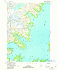
USGS Topo Quad Seward D-4, Alaska
Download Seward D-4
Download Seward D-4
Southern Latitude:
60.7500 N
Eastern Longitude:
-148.1250
Northen Latitude:
61.0000 N
Western Longitude:
-148.5000
Bay(s) in Seward D-4
Port Wells,
Bettles Bay,
Entry Cove,
Harrison Lagoon,
Hobo Bay,
Hollow Bight,
Hummer Bay,
Logging Camp Bay,
Pigot Bay,
Pirate Cove,
Squirrel Cove,
Surprise Cove,
Ziegler Cove,
Cape(s) in Seward D-4
Point Cochrane,
Point Culross,
Point Esther,
Point Pigot,
Blackstone Point,
Decision Point,
Slope Point,
Squirrel Point,
Strong Point,
Glacier(s) in Seward D-4
Bettles Glacier,
Dirty Glacier,
Wedge Glacier,
Island(s) in Seward D-4
Esther Rock,
Mine(s) in Seward D-4
Granite Mine,
Lansing Mine,
Mountain(s) in Seward D-4
Pigot Benchmark,
Park(s) in Seward D-4
Bettles Bay State Marine Park,
Decision Point State Marine Park,
Entry Cove State Marine Park,
Surprise Cove State Marine Park,
Ziegler Cove State Marine Park,
Stream(s) in Seward D-4
Hobo Creek,
Hummer Creek,
Lagoon Creek,
