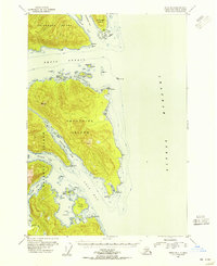
USGS Topo Quad Sitka B-3, Alaska
Download Sitka B-3
Download Sitka B-3
Southern Latitude:
57.2500 N
Eastern Longitude:
-134.6667
Northen Latitude:
57.5000 N
Western Longitude:
-135.0000
Abandoned Towns(s) in Sitka B-3
Sitkoh,
Archipelago(s) in Sitka B-3
Eva Islands,
Bar(s) in Sitka B-3
Coleman Reef,
Midway Reef,
Morris Reef,
Plover Rock,
Bay(s) in Sitka B-3
The Basin,
Echo Cove,
Florence Bay,
Kelp Bay,
Middle Arm Kelp Bay,
South Arm Kelp Bay,
Cape(s) in Sitka B-3
Point Craven,
Point Hanus,
Point Hayes,
Point Lull,
Point Thatcher,
North Point,
Portage Point,
South Point,
Channel(s) in Sitka B-3
Portage Arm,
Thatcher Channel,
Island(s) in Sitka B-3
Catherine Island,
Crow Island,
Fairway Island,
Pond Island,
Svensen Rock,
Traders Island,
Yellow Rock,
Zubof Rock,
River(s) in Sitka B-3
Glacial River,
Stream(s) in Sitka B-3
Cutthroat Creek,
