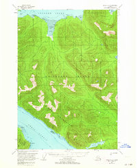
USGS Topo Quad Sitka C-4, Alaska
Download Sitka C-4
Download Sitka C-4
Southern Latitude:
57.5000 N
Eastern Longitude:
-135.0000
Northen Latitude:
57.7500 N
Western Longitude:
-135.3333
Bay(s) in Sitka C-4
Corner Bay,
Kadashan Bay,
Trap Bay,
Cape(s) in Sitka C-4
Point Elizabeth,
Peschani Point,
Channel(s) in Sitka C-4
Peril Strait,
Dam(s) in Sitka C-4
Corner Bay Dam,
Island(s) in Sitka C-4
False Island,
Strawberry Island,
Lake(s) in Sitka C-4
Sitkoh Lake,
River(s) in Sitka C-4
Kadashan River,
Stream(s) in Sitka C-4
Corner Creek,
Duffield Creek,
Hook Creek,
Tonalite Creek,
Trail(s) in Sitka C-4
Sitkoh Lake Trail,
