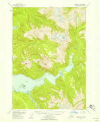
USGS Topo Quad Sumdum B-4, Alaska
Download Sumdum B-4
Download Sumdum B-4
Southern Latitude:
57.2500 N
Eastern Longitude:
-133.0000
Northen Latitude:
57.5000 N
Western Longitude:
-133.3333
Bay(s) in Sumdum B-4
Port Houghton,
North Arm Port Houghton,
Channel(s) in Sumdum B-4
Sandborn Canal,
Island(s) in Sumdum B-4
Rabbit Island,
Walter Island,
Lake(s) in Sumdum B-4
Alice Lake,
Little Lagoon,
Salt Chuck,
The Salt Chuck,
Mountain(s) in Sumdum B-4
Washington Peak,
