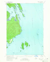
USGS Topo Quad Sumdum B-6, Alaska
Download Sumdum B-6
Download Sumdum B-6
Southern Latitude:
57.2500 N
Eastern Longitude:
-133.6667
Northen Latitude:
57.5000 N
Western Longitude:
-134.0000
Archipelago(s) in Sumdum B-6
The Brothers,
Bay(s) in Sumdum B-6
Last Chance Harbor,
Snug Cove,
Cape(s) in Sumdum B-6
Point Gambier,
Point Pybus,
Church Point,
False Point Pybus,
Gem Point,
Grunt Point,
Scald Point,
Square Point,
Island(s) in Sumdum B-6
The Five Fingers,
Chapel Island,
Chock Island,
East Brother Island,
Gain Island,
Gambier Island,
Good Island,
Muse Island,
Price Island,
Romp Island,
Round Rock,
Sail Island,
Tree Island,
West Brother Island,
Pass(s) in Sumdum B-6
Old Mans Slough,
