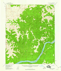
USGS Topo Quad Tanana B-3, Alaska
Download Tanana B-3
Download Tanana B-3
Southern Latitude:
65.2500 N
Eastern Longitude:
-151.0000
Northen Latitude:
65.5000 N
Western Longitude:
-151.5000
Hill(s) in Tanana B-3
Moosehead Rack,
Mountain(s) in Tanana B-3
Senatis Mountain,
Range(s) in Tanana B-3
Rampart Mountains,
Rapids(s) in Tanana B-3
The Rapids,
Stream(s) in Tanana B-3
Bonanza Creek,
Cheyenne Creek,
Forks Creek,
Homestake Creek,
Jordan Creek,
Larsen Creek,
Maggie Creek,
Morelock Creek,
Quartz Creek,
Rosa Creek,
Wally Creek,
Windy Creek,
