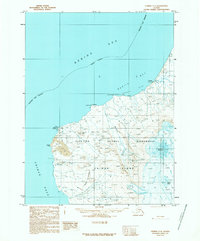
USGS Topo Quad Unimak C-3, Alaska
Download Unimak C-3
Download Unimak C-3
Southern Latitude:
54.5000 N
Eastern Longitude:
-164.6667
Northen Latitude:
54.7500 N
Western Longitude:
-165.0000
Abandoned Towns(s) in Unimak C-3
Pogromni,
Bay(s) in Unimak C-3
Cataract Cove,
Dublin Bay,
Beach(s) in Unimak C-3
Airplane Flats,
Cape(s) in Unimak C-3
Cape Sarichef,
Raven Point,
Sealion Point,
Survey Point,
Glacier(s) in Unimak C-3
Glacier G195297E54506N,
Hill(s) in Unimak C-3
Red Hill,
The Sisters,
Lake(s) in Unimak C-3
Tarheel Lagoon,
Mountain(s) in Unimak C-3
Faris Peak,
Pogromni Volcano,
Stream(s) in Unimak C-3
Beartrack Creek,
