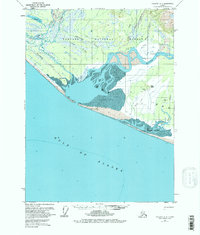
USGS Topo Quad Yakutat A-2, Alaska
Download Yakutat A-2
Download Yakutat A-2
Southern Latitude:
59.0000 N
Eastern Longitude:
-138.3750
Northen Latitude:
59.2500 N
Western Longitude:
-138.7500
Bay(s) in Yakutat A-2
Dry Bay,
Island(s) in Yakutat A-2
Bear Island,
Lake(s) in Yakutat A-2
Square Lake,
Pass(s) in Yakutat A-2
Cabin Slough,
Rapids(s) in Yakutat A-2
First Rapids,
River(s) in Yakutat A-2
Alsek River,
East Alsek River,
Taaltsug River,
Tanis River,
Tlegan River,
Vankahini River,
Stream(s) in Yakutat A-2
Cannery Creek,
Clear Creek,
Emile Creek,
Gines Creek,
Muddy Creek,
Shack Creek,
Split Creek,
Williams Creek,
