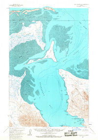
USGS Topo Quad Port Moller D-3, Alaska
Download Port Moller D-3
Download Port Moller D-3
Southern Latitude:
55.7500 N
Eastern Longitude:
-160.6667
Northen Latitude:
56.0000 N
Western Longitude:
-161.0000
Bar(s) in Port Moller D-3
Crow Reef,
Halftide Rock,
Midway Reef,
Village Spit,
Bay(s) in Port Moller D-3
Herendeen Bay,
Mine Harbor,
Mud Bay,
Cape(s) in Port Moller D-3
Black Point,
Bluff Point,
Bold Bluff Point,
Cape Rozhnof,
Coal Point,
Crow Point,
Point Divide,
Doe Point,
Point Edward,
Fawn Point,
Low Point,
Marble Point,
Middle Point,
Ross Point,
Second Cape,
Shingle Point,
Third Cape,
Channel(s) in Port Moller D-3
Hague Channel,
Johnston Channel,
Cliff(s) in Port Moller D-3
Coal Bluff,
Island(s) in Port Moller D-3
Deer Island,
Eagle Rock,
Gull Island,
Stream(s) in Port Moller D-3
Coal Creek,
Johnson Fork,
Lynden Creek,
Valley(s) in Port Moller D-3
Coal Valley,
Village(s) in Port Moller D-3
Herendeen Bay,
