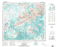
USGS Topo Quad Port Moller, Alaska
Download Port Moller
Download Port Moller
Southern Latitude:
55.0000 N
Eastern Longitude:
-160.0000
Northen Latitude:
56.0000 N
Western Longitude:
-162.0000
Archipelago(s) in Port Moller
Pavlof Islands,
Shumagin Islands,
Bar(s) in Port Moller
Caton Shoal,
Crow Reef,
Halftide Rock,
Midway Reef,
Moller Spit,
Moses Rocks,
Popof Reef,
Unga Reef,
Unga Spit,
Village Spit,
Weedy Shoals,
Bay(s) in Port Moller
Acheredin Bay,
American Bay,
Balboa Bay,
Baralof Bay,
Beaver Bay,
Ben Green Bight,
Blind Breaker,
Canoe Bay,
Caton Cove,
Chichagof Bay,
Chinaman Lagoon,
Clark Bay,
Coal Bay,
Coal Harbor,
Delarof Harbor,
Dolgoi Harbor,
Dorenoi Bay,
Dry Lagoon,
Dushkin Lagoon,
Eagle Harbor,
Falmouth Harbor,
Fox Hole,
Frying Pan,
Grosvold Bay,
Herendeen Bay,
Humboldt Harbor,
Jackson Harbor,
Jackson Lagoon,
Korovin Bay,
Left Head,
Left Head,
Lefthand Bay,
Little Norway,
Long John Lagoon,
Lumber Bay,
Mine Harbor,
Port Moller,
Mud Bay,
Mud Bay,
Mud Bay,
Nelson Lagoon,
Orzinski Bay,
Otter Bay,
Pavlof Bay,
Pirate Cove,
Porpoise Harbor,
Red Cove,
Right Head,
San Diego Bay,
Sanborn Harbor,
Shoal Bay,
Simeon Bay,
Volcano Bay,
West Cove,
Windbound Bay,
Zachary Bay,
Beach(s) in Port Moller
Long Beach,
Ocean Beach,
Cape(s) in Port Moller
Acheredin Point,
Point Aliaksin,
Arch Point,
Bay Point,
Big Hill,
Black Point,
Black Point,
Bluff Point,
Bluff Point,
Bluff Point,
Bluff Point,
Blunt Point,
Bold Bluff Point,
Cape Aliaksin,
Cape Devine,
Cape Horn,
Cape Rozhnof,
Cape Tolstoi,
Coal Point,
Cross Cape,
Crow Point,
Danger Point,
Point Divide,
Doe Point,
Dolgoi Cape,
East Head,
East Point,
Point Edward,
Elephant Point,
Entrance Point,
Fawn Point,
Franks Point,
Franz Point,
Granite Point,
Gravel Point,
Gull Point,
Harbor Point,
Hardscratch Point,
Low Point,
Marble Point,
McGinty Point,
Middle Point,
Monolith Point,
Moss Cape,
North Head,
Pinnacle Point,
Quartz Point,
Reef Point,
Renshaw Point,
Ross Point,
Sand Point,
Scotland Point,
Seal Cape,
Second Cape,
Settlement Point,
Shingle Point,
Sombrero Point,
Southwest Point,
Swedania Point,
Third Cape,
Unga Cape,
Waterfall Point,
West Head,
West Point,
Channel(s) in Port Moller
Gorman Strait,
Hague Channel,
Iliasik Passage,
Johnston Channel,
Korovin Strait,
Popof Strait,
Unga Strait,
Cliff(s) in Port Moller
Coal Bluff,
Dark Cliffs,
East Head,
Macks Head,
Popof Head,
Rock Cliff,
White Bluff,
Wooly Head,
Dam(s) in Port Moller
New England Fish Company Dam Sand Point,
Squaw Harbor Dam,
Flat(s) in Port Moller
Kagayan Flats,
Hill(s) in Port Moller
Flagstaff Hill,
Happys Hill,
Miner Hill,
Island(s) in Port Moller
Andronica Island,
Arch Rock,
Ballast Island,
Basset Island,
Black Rock,
Clay Island,
Cross Island,
Deer Island,
Dolgoi Island,
Eagle Rock,
East Rock,
Egg Island,
Egg Island,
Egg Island,
Egg Island,
Elephant Rock,
Entrance Island,
Flat Island,
Goloi Island,
Guillemot Island,
Gull Island,
Gull Island,
Gull Island,
Halfway Rock,
The Haystacks,
Henderson Island,
High Island,
Inner Iliasik Island,
Ivan Island,
Jude Island,
Karpa Island,
Kelly Rock,
Kennoys Islands,
Korovin Island,
Little Egg Island,
Lump Island,
Macks Head Island,
Midway Rock,
Olga Islands,
Omega Island,
Outer Iliasik Island,
The Pinnacle,
Poperechnoi Island,
Popof Island,
Range Island,
Range Islet,
Round Island,
Round Island,
Scotland Rock,
Sealion Rocks,
South Rocks,
Ukolnoi Island,
Ukolnoi Rocks,
Unga Island,
The Whaleback,
Wosnesenski Island,
Lake(s) in Port Moller
Big Fish Lake,
Coast Lake,
Divide Lake,
Hoodoo Lake,
Knutson Lake,
Salt Water Lagoon,
Sapsuk Lake,
Mine(s) in Port Moller
Apollo Mine,
Mountain(s) in Port Moller
Apollo Mountain,
Bloomer Peak,
Bobrovia Mountain,
Cathedral Peak,
Chichagof Peak,
Cone Peak,
Mount Dana,
Mount Davidson,
Eagle Mountain,
Mount Hague,
Hoodoo Mountain,
Little Pavlof,
Pavlof Sister,
Pavlof Volcano,
Pinnacle Peak,
Pyramid Mountain,
Red Mountain,
Staniukovich Mountain,
Mount Stepo,
Tolstoi Peak,
Trader Mountain,
Range(s) in Port Moller
Trap House Hills,
River(s) in Port Moller
Beaver River,
Canoe Bay River,
Caribou River,
David River,
Lefthead River,
Sapsuk River,
Stream(s) in Port Moller
Bishop Creek,
Coal Creek,
Coleman Creek,
Foster Creek,
Four Bear Creek,
Frank Creek,
Humpy Creek,
Johnson Creek,
Johnson Fork,
Lawrence Creek,
Lynden Creek,
Mino Creek,
Ness Creek,
Peterson Creek,
Portage Creek,
Steelhead Creek,
Susie Creek,
Valley(s) in Port Moller
Buck Valley,
Chichagof Valley,
Coal Valley,
Deer Valley,
Grass Valley,
Lawrence Valley,
Portage Valley,
Wolverine Gulch,
Village(s) in Port Moller
Herendeen Bay,
Port Moller,
Sand Point,
Squaw Harbor,
Unga,
