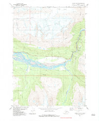
USGS Topo Quad Valdez A-6 SE, Alaska
Download Valdez A-6 SE
Download Valdez A-6 SE
Southern Latitude:
61.0000 N
Eastern Longitude:
-145.8750
Northen Latitude:
61.1250 N
Western Longitude:
-146.0625
Glacier(s) in Valdez A-6 SE
Corbin Glacier,
Glacier G213982E61094N,
Glacier G214027E61088N,
Glacier G214070E61096N,
Hogback Glacier,
Keystone Glacier,
Ice Climbing Route(s) in Valdez A-6 SE
Bridal Veil Falls (Ice Climb),
Cidersicle,
Crystal Visions,
Dire Straits,
Fang Gully,
Fishing for Fools,
Flying Cloud,
Foolagain,
Glass Onion,
Greensteps,
Hanging Tree Left,
Hanging Tree Right,
Horsetail Falls (Ice Climb),
Hung Jury,
Jaws Wall,
Mud Slide,
My Three Rats,
Oil Slick,
Popsicle Pillar,
POS,
Simple Twist of Fate,
Ski Race,
The Bight,
VAC,
Mountain(s) in Valdez A-6 SE
Hogsback,
Peak(s) in Valdez A-6 SE
Heidi Peak,
Stream(s) in Valdez A-6 SE
Brown Creek,
Browns Creek,
Trail(s) in Valdez A-6 SE
Browns Creek Trail,
Pack Trail of 1899,
Valley(s) in Valdez A-6 SE
Keystone Canyon,
Snowslide Gulch,
Waterfall(s) in Valdez A-6 SE
Bridal Veil Falls,
Horsetail Falls,
Rudleston Falls,
