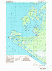
USGS Topo Quad Yakutat C-5 SW, Alaska
Download Yakutat C-5 SW
Download Yakutat C-5 SW
Southern Latitude:
59.5000 N
Eastern Longitude:
-139.6875
Northen Latitude:
59.6250 N
Western Longitude:
-139.8750
Bar(s) in Yakutat C-5 SW
Prince Shoal,
Tick Shoal,
Tzuse Shoal,
Village Shoal,
Bay(s) in Yakutat C-5 SW
The Lagoon,
Port Mulgrave,
Ahduck Bay,
Deep Bay,
Gonakadetseat Bay,
Graveyard Cove,
Monti Bay,
Puget Cove,
Rurik Harbor,
Sea Otter Bay,
Shipyard Cove,
Beach(s) in Yakutat C-5 SW
Khantaak Beach,
Cape(s) in Yakutat C-5 SW
Point Turner,
Point Munoz,
Point Carrew,
Ankau Head,
Arrecifes Point,
Hatchet Point,
Ocean Cape,
Phipps Cape,
Phipps Peninsula,
Pyramid Point,
Channel(s) in Yakutat C-5 SW
The Ankau,
Canoe Pass,
Johnstone Passage,
Yakutat Roads,
City(s) in Yakutat C-5 SW
Yakutat,
Island(s) in Yakutat C-5 SW
Canoe Island,
Khantaak Island,
Lake(s) in Yakutat C-5 SW
Aka Lake,
Ankau Saltchucks,
Kardy Lake,
Laguna de la Frezas,
Rocky Lake,
Summit Lake,
Summit Lakes,
Stream(s) in Yakutat C-5 SW
Ophir Creek,
T-awat Creek,
