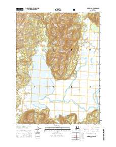
USGS Topo Quad Cordova B-1 SW, Alaska
Download Cordova B-1 SW
Download Cordova B-1 SW
Southern Latitude:
60.2500 N
Eastern Longitude:
-144.1875
Northen Latitude:
60.3750 N
Western Longitude:
-144.3750
Cape(s) in Cordova B-1 SW
Poul Point,
Lake(s) in Cordova B-1 SW
Bering Lake,
Mountain(s) in Cordova B-1 SW
Mount Hamilton,
Stream(s) in Cordova B-1 SW
Basin Creek,
Carbon Creek,
Dick Creek,
Falls Creek,
Falls Eagle,
Powers Creek,
Rope Creek,
Shepherd Creek,
Split Creek,
Steele Creek,