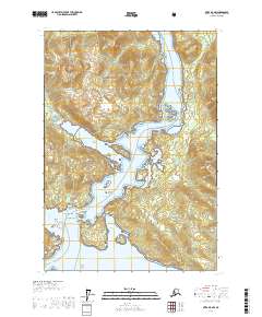
USGS Topo Quad Sitka B-5 NW, Alaska
Download Sitka B-5 NW
Download Sitka B-5 NW
Southern Latitude:
57.3750 N
Eastern Longitude:
-135.5000
Northen Latitude:
57.5000 N
Western Longitude:
-135.6667
Bar(s) in Sitka B-5 NW
E Francis Rock,
Midway Rock,
Nixon Shoal,
Wayanda Ledge,
Bay(s) in Sitka B-5 NW
Baby Bear Bay,
Bear Bay,
Deep Bay,
Launch Cove,
Liesnoi Shoal,
Schulze Cove,
Suloia Bay,
Cape(s) in Sitka B-5 NW
Point Siroi,
Point Sinbad,
Arthur Point,
Fish Point,
Island Point,
Middle Point,
Mountain Head,
Near Point,
Pinta Head,
Rapids Point,
Schulze Head,
Sergius Point,
Shoal Point,
Struya Point,
Suloia Point,
Yellow Point,
Channel(s) in Sitka B-5 NW
Adams Channel,
Canoe Pass,
Rose Channel,
Sergins Narrows,
Sergius Channel,
Island(s) in Sitka B-5 NW
Arthur Island,
Arthur Island,
Bear Bay Island,
Big Island,
Big Rose Island,
East Francis Rock,
Grasstop Rock,
Haley Rocks,
Liesnoi Island,
Little Island,
Little Rapids Island,
Little Rose Island,
Piper Island,
Prolewy Rock,
Rapids Island,
Suloia Islet,
Suloia Rock,
W Francis Rock,
West Francis Rock,
Park(s) in Sitka B-5 NW
Big Bear - Baby Bear State Marine Park,
Pass(s) in Sitka B-5 NW
Sergius Narrows,
Rapids(s) in Sitka B-5 NW
North Rapid,
Southern Rapids,
Stream(s) in Sitka B-5 NW
Range Creek,