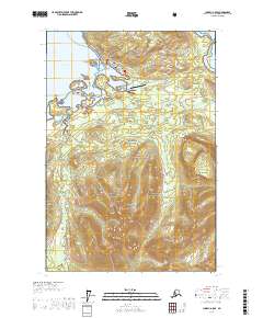
USGS Topo Quad Juneau A-5 SE, Alaska
Download Juneau A-5 SE
Download Juneau A-5 SE
Southern Latitude:
58.0000 N
Eastern Longitude:
-135.3333
Northen Latitude:
58.1250 N
Western Longitude:
-135.5000
Cape(s) in Juneau A-5 SE
False Point,
Game Point,
Grave Point,
Harbor Point,
City(s) in Juneau A-5 SE
Hoonah,
Dam(s) in Juneau A-5 SE
Shotter Creek Dam,
Fictional Place(s) in Juneau A-5 SE
Delos Crossing,
Island(s) in Juneau A-5 SE
Long Island,
Pitt Island,
Lake(s) in Juneau A-5 SE
Site Lake,
Stream(s) in Juneau A-5 SE
Game Creek,
Gartina Creek,
Trail(s) in Juneau A-5 SE
Spasski Trail,
Village(s) in Juneau A-5 SE
Whitestone Logging Camp,